DAY 43 - MONDAY
JULY 30, 2012
Monday was a travel day, beginning at 10:42 AM.
By 11:21 AM, we passed through Rochester, WA,
so fast all we saw was a Post Office and a Middle School.
On the "outskirts of Town"
there was a Lumber Yard with extremely long.
skinned trees.
A log truck pulled out from the lumber yard,
and was in front of us for the next 40 miles.
Our destination was only a 66 mile distance,
so we arrived at the KOA in Castle Rock, Washington by 12:15 PM.
We had a great BLT Salad at Burger King, and then
drove to Mount St. Helen's Visitor Center.
We paid $5 each for this State of Washington operated facility.
While there we viewed a 17 minute video telling us about the June 12, 1980,
Eruption. It was a powerful story.
A layer of Clouds hid a full view of Mount St. Helen from us.
When we stopped to take wildflower pictures,
the Cloud descended upon us,
so we opted to turn around and wait until tomorrow
to climb to our final destination of the
Johnston Ridge Observatory.
All total, today, we drove 71 miles round trip in our
quest to see Mount St. Helen.
The road twists and curves for 50 miles to the top, and we stopped
short at the Forest Viewing Center,
with 19 more miles to get to the top.
FOXGLOVE
DAY 44 - TUESDAY
JULY 31, 2012
Today, we took time to go into Castle Rock and found a Barber/Hair Salon
where we both had our hair cut. While in town, we took a picture of a Mural
of Mount St. Helen's before the Eruption.
PEPER'S was a great choice where we had
Taco Salads. Russ enjoyed his in a Corn Shell, and
Rita had hers in a salad bowl.
At 2 PM, we started up Rt. 504 from Peper's to drive the 50 miles to
Johnston Ridge Observatory. We had our first view of
Mount St. Helen's by 2:20 PM,
This view was taken when we still
had 46 miles to go,
to the top.
We stopped to take more pictures
when we had driven another 31 miles.
The flowers in the foreground are
INDIAN PAINTBRUSH
and DAISYS.
RUSS and RITA
at JOHNSTON RIDGE OBSERVATORY
which is opposite Mount St. Helen's
and was approximately seven miles
across from it.
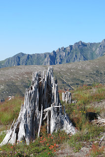
The devastation of the Eruption
effected 230 square miles, so
we could see up close what
was left after the lava covered
the area, and destroyed the
forest.
The closest image I could get of
what is left on the Face.
The seven miles span between
Mount St. Helen and where
we were, is still a GREY,
lifeless stretch.
This reforestration by Weyerhauser
was planted in 1983. At various
points in our 54 mile
return trip,
we saw signs indicating
the date of replanting and
the expected harvest dates.
It appears that it takes 45 years
to reach maturity, since those
planted in 1983 were scheduled
for harvest in 2028.
One last note:
Our National Parks Pass was useful today
at the Mount St. Helen's National Volcanic Monument/Museum.
Otherwise, it would have cost us $8 each.


No comments:
Post a Comment